NWop site Directions with Street and Sat Maps

AO information, directions, and maps of approved AOs are found here

Moderator: Moderators

NWop site Directions with Street and Sat Maps

Postby TACAdmin on Wed Oct 01, 2008 2:44 pm

*EDIT- Google map with route marked from I-10. To find site follow I10 north from Tucson*

http://maps.google.com/maps/ms?ie=UTF8& ... 93e4&msa=0


Hey all! Since I had a hard time getting all the relevant site info I needed to attend my first game at the NWop site I wanted to throw a one-stop-shop togther for new folks to get the directions they need to this site with minimal fuss.

Location: NWop site or Santa Cruz Delta

Directions: Head West on I-10 untill you reach Avra Valley Road. Turn left at the end of the off ramp and follow Avra Valley Rd for a mile or two. Watch for a bridge. Once you cross the bridge immediatly turn left ino the dirt parking lot. Park your vehcile their and hike down the dirt road to the rally points.


City level street map with Avra Valley exit circled:

Image


Local level street map of the opsite with parking area circled:

Image


Local level sat map of the opsite with parking area circled, arrows along hiking path and usual rally points in squares:

Image


Hope new folks find this helpful.
TACAdmin
Site Admin
 
Posts: 43
Joined: Thu Sep 11, 2008 10:41 am

Re: NWop site Directions with Street and Sat Maps

Postby KileyHAZ on Sat Apr 25, 2009 2:57 pm

On 4.25.09 members of TAC were approached by a citizen who demanded we leave NWOpsite as it was now a park of the city of marana. We conceded and broke up the game. Investigation of the matter shows the following:

The South end of NWopsite is posted as a park. You can find more information on the marana.com website under Rock Disc Golf. It is now within Marana city limits and thus off limits to us.

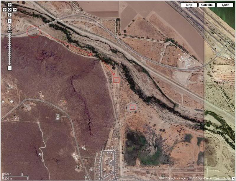
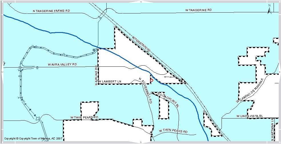
The investigation also shows that the north end of the field (from the plateau section north) is still unincorporated land and thus still usable.

As such, it is required that all players playing at this AO in the future not go any further south then the plateau area. It is recommended you give it a wide birth since a disc golf hole is located on the plateau and players in the area may accidentally engage no players. Its is STRONGLY recommended that players print out the following information so they have documents showing the land we are playing on is not part of the park and is unincorporated should they be approached by disc golf players or LEOs. Please, always be respectful of LEOs as a bad rap for us could make finding other county AOs difficult. Thank you for your time.

[Dot shows plateau in relation to the rest of the site]
Image

[Dot shows plateau in relation to the rest of the site]
[Blue is Marana city limits]
Image

More about the Rock Disc Golf Course
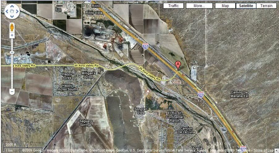
http://www.marana.com/index.aspx?NID=770

Additional reference info:
NWopsite resides on:
T12S R12E Section 8

Assesor Record of Plot owners:
http://www.asr.pima.gov/links/frm_Searc ... &section=8

Actual plots located on NWopsite:
http://www.asr.pima.gov/links/frm_Parce ... xyear=2010

**Note, both of the above are owned by the county and zoned for flood control.

Here are the aerials that map to those plots:
http://dot.pima.gov/gis/pictometry/latl ... -111.14231
http://dot.pima.gov/gis/pictometry/latl ... -111.13867
"If everyone is thinking alike, someone isn't thinking"
Image
User avatar
KileyHAZ
Executive Advisor
 
Posts: 1551
Joined: Fri Oct 10, 2008 11:14 am
Location: Red Rock AZ

Re: NWop site Directions with Street and Sat Maps

Postby The Honey Badger on Fri May 29, 2015 3:43 pm

NWOP is still a good Field. 05/29/2015.
Image
User avatar
The Honey Badger
TAC CO
 
Posts: 702
Joined: Fri Apr 23, 2010 7:11 pm
Location: Tortalita (NW I10/Cortaro)


Return to AO Information

Who is online

Users browsing this forum: No registered users and 1 guest

cron