Page 1 of 5

Mt. Lemmon AO

PostPosted: Tue Nov 18, 2008 9:03 am
by KileyHAZ
Since no one has come back to me or the other board members with actual directions or GPS readings to a quiet section of Mt Lemmon where I could make my pitch to the Forest Service decided to take matters into my own hands for an event DH is brewing up for early next year.

I reached out to the Santa Catalina special uses staff this morning with a general request and have decided to start the search. If you don't like the area I'm targeting for the AO then you have no one to blame for inaction to this point but yourself.

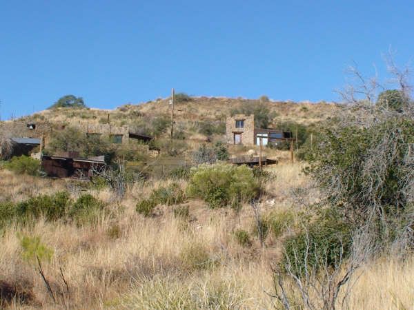
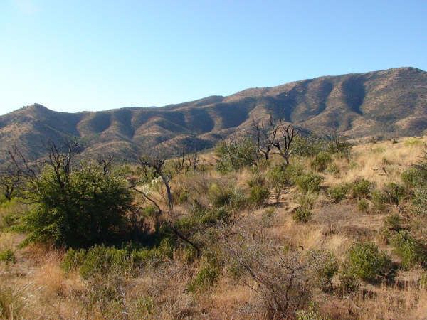
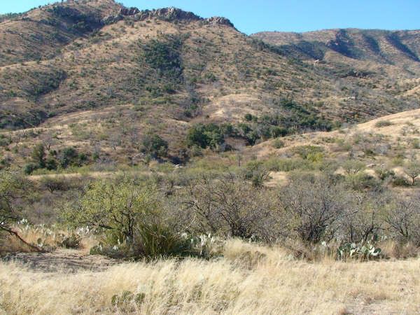
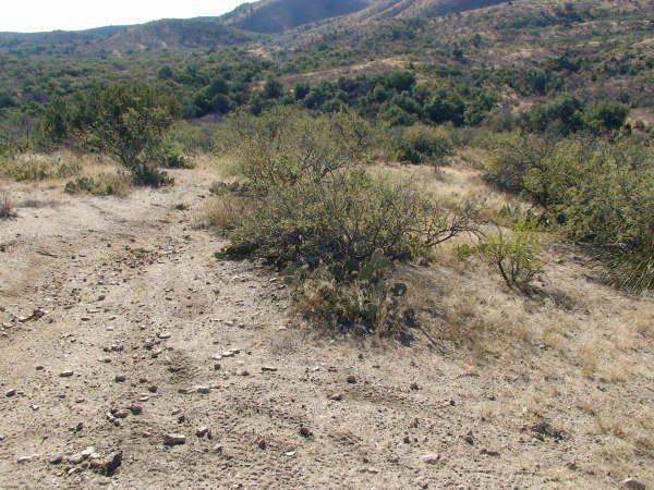
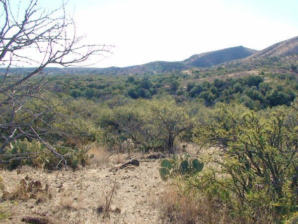
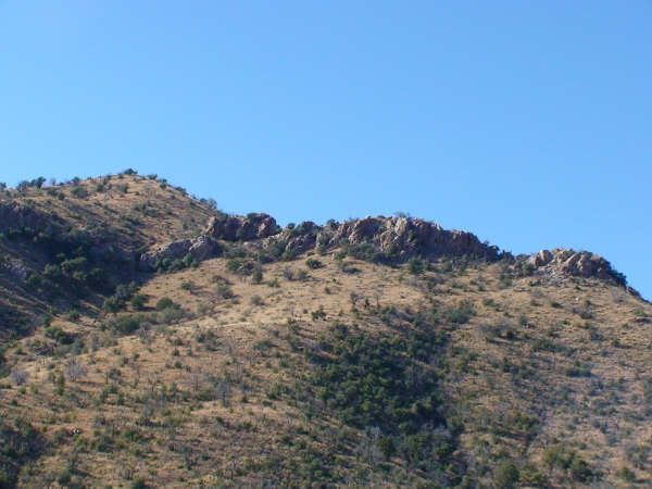
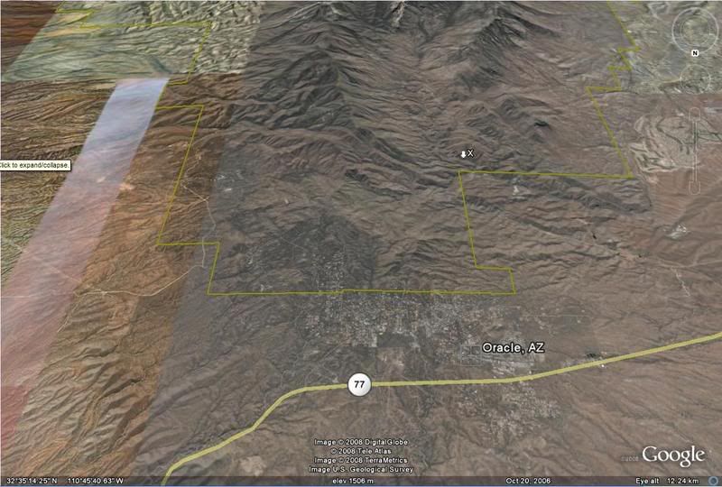
Anyhow, the area I am targeting for getting the AO is the back side of Mt Lemmon near Oracle. This is the less trafficked side of the mountain so we may have a better chance of finding a good AO that is not 90 degree inclines all of the time. I have attached a map showing the area I think is most promising for finding an AO (marked X). Keep in mind this map is facing southbound. I'll keep folks informed of the progress and will be looking for volunteers or skipping a weekend or two to scout the area and find a spot so I can make a second pitch based on actual locale.

Image

Re: Mt. Lemmon AO

PostPosted: Tue Nov 18, 2008 12:40 pm
by IconarmsDealer
As you know I home school my son, we get done before noon most days. Id be down to LRRP that for you. Can yopu email me a better Picture with any roads, Lat/ Longs we will scout digitaly photgraph as you direct. PM me with info. This may also be the place to have an overnight as I spoke of in the JUNE thread

Re: Mt. Lemmon AO

PostPosted: Wed Nov 19, 2008 6:56 am
by KileyHAZ
IconarmsDealer wrote:As you know I home school my son, we get done before noon most days. Id be down to LRRP that for you. Can yopu email me a better Picture with any roads, Lat/ Longs we will scout digitaly photgraph as you direct. PM me with info. This may also be the place to have an overnight as I spoke of in the JUNE thread


The proposed site above (site A) will have to be scouted by vehicle, you can simply drive out to oracle or the bipsphere head south and look around for signage saying your in coronado national forest then look around for areas off the beaten path that look 'interesting'.

Site B, which I did some 3d map recon work on looks a bit more promising though it is further out. Below you will find a link with turn by turn directions to site B and the GPS coordinates.

http://maps.google.com/maps?f=q&hl=en&g ... =UTF8&z=11

32°33'47.49"N
110°44'23.51"W

The things to keep in mind are:
Must be away from established camp grounds and recreational traffic
Must have established roadway (dirt or pavement) to the staging area
Preferably easy to follow directions to get in and out so we dont have to convoy every new player out there

Feel free to check it out otherwise I'll get out there soonish.

What we will need for our permit is:
Clearly delineated area of play with 4 gps points showing the corners
gps point for the staging area
photos of the area

I can get everything else off of goggle earth

EDIT:
SITE B (from above) Pictures, courtesy of Iconarms
Image
Image
Image
Image
Image
Image

Re: Mt. Lemmon AO

PostPosted: Wed Nov 19, 2008 7:07 am
by IconarmsDealer
Copy that will take a drive out there first thing in the morning (thursday)

Re: Mt. Lemmon AO

PostPosted: Wed Nov 19, 2008 12:47 pm
by Farslayer
Icon, please take some pics.

Re: Mt. Lemmon AO

PostPosted: Wed Nov 19, 2008 1:42 pm
by IconarmsDealer
Photos ,Got it!

Re: Mt. Lemmon AO

PostPosted: Thu Nov 20, 2008 7:22 am
by IconarmsDealer
we are leaving right now I will let you know what we find and send pics

Re: Mt. Lemmon AO

PostPosted: Thu Nov 20, 2008 12:28 pm
by IconarmsDealer
Ok We have made it back- The directions are not as spot on as they could be The GOOGLE directions go bad at #8.
To get to the proper spot: Right turn on Mt LEMMON Hwy. Proceed until the pavemnet ends at the fork. Guide Right until you come to Triangle Y Ranch Camp This is CAMPO BONITO

ROAD: the roads are in great shape. Passable by all but the very lowest passenger cars. They are steep in several places and very narrow.

LANDSCAPE: Steep hills, canyons, scattered Rock out croppings. Thick Bottle brush, Cacti, Manzanita, some Deer berry, and Mesquite. Many DEEP Canyons/Wash some look to get plenty of Water during Rainy seasons.

Elevation 3500-5000-Ft/ASL

Once on Campo Bonito you will come to 2 Forks;

Fork 1: 32.24.090N/110.43.181 W Stay Left
on this section you will pass a pull out 2 32.33.967 N/110.43.502 Nw this looks like it a good ralley point and possiable staging area.

Proceed to Fork 2: 32.33.896 N/110.43.677 W stay Right


we stopped at a short pull out 2-3 cars deep @ 32.33.777N/ 110.43.922 W, and walked down into the canyopns this canyon runs a great doistance and look like a snipers wet dream, Ghillie suit = DEAD Soldiers :twisted:

NOTE: there is little to no space to park along the roads. the bush comes to the edges of the road in most spots

At the end of CAMPO BONITO is a historical site :OAK CREEK RANCH I was so hoping it was an abandon structure as it has Mountian side fortress written all over it.

I will send Kiley Pictures ASAP. IMO it looks like a doabel AO, But I will leave this to ther Pros

Hope this helps

Re: Mt. Lemmon AO

PostPosted: Thu Nov 20, 2008 4:09 pm
by Seedy
sounds pretty cool!

Re: Mt. Lemmon AO

PostPosted: Thu Nov 20, 2008 4:32 pm
by Farslayer
I just popped one.... :D